Subject: Social Studies
Lesson Length: 25 - 30 mins
Topic: Colonial Regions
Grade Level: 5
Standards / Framework:
Brief Description: Students will learn how the colonial regions; northern, middle, and southern differed economically by exploring the advantages of their locations and what they exported.
Know Before You Start: Students should have a good understanding of where the colonial regions; northern, middle, and southern are located on both a physical and political map.
Hook:
-
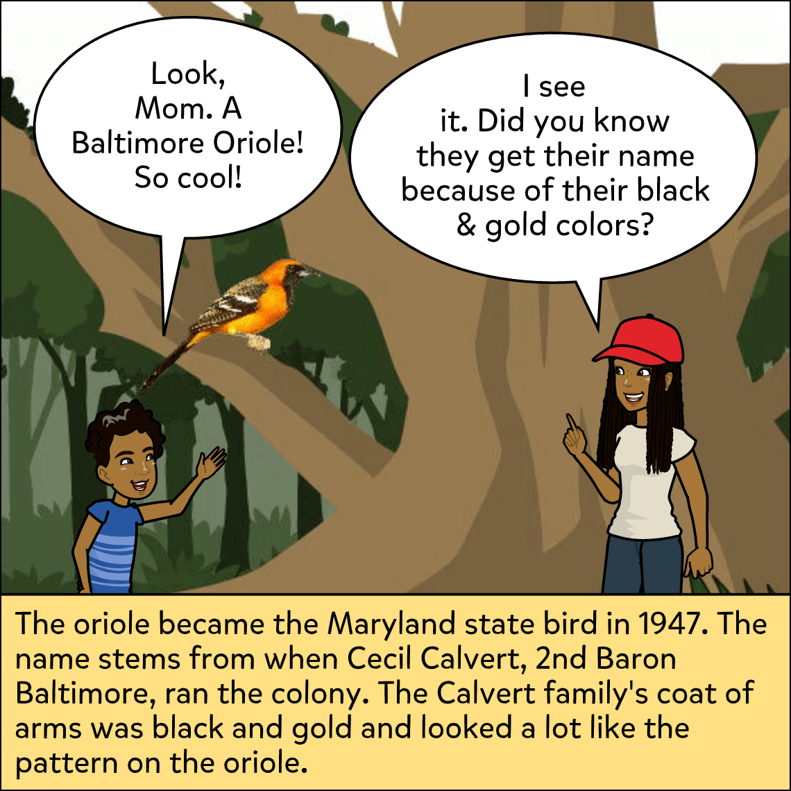
Read and discuss the sample comic.
-
How do you think having a lot of forests helped the northern colonies prosper?
-
-
Show a map of the original thirteen colonies separated by region.
-
Have students brainstorm what they believe the colonial regions exported based on their location.
Activity:
- Present these three prompts to students:
- Which colonial region do you think had the most access to waterways?
- Which colonial region do you think was known as the breadbasket?
- Which colonial region do you think had the most wildlife?
- Using the sample comic as a guide, have students respond to one of the prompts in a three-panel comic.
- Have them not only answer the prompt with the colonial region; northern, middle, or southern, but also use the comic to explain why they believe they are correct.
- Panel 1: Restate the prompt/question.
- Panels 2 and 3: Respond to the prompt and explain your reasoning.
Closure:
- Divide the class into groups based on the prompt they chose. Have them discuss their comics within their group.
Differentiation:
- Allow students to use speech-to-text feature.
- Allow students to use the voiceover feature to read their comics aloud.
- Assign one of the prompts to each student.
Resources:
- Comic to print or display: Comic.
Suggested Content:
 National Parks
 Rural
Rural